Log in
All resources
Create a design
675 Free Artworks of Ships On Maps
bibliothèque nationale de france
john rocque 1746 crops from library of congress
john rocque
a map of the british empire in america with the french and spanish settlements adjacent thereto
maps by willem and johannes blaeu
considérations géographiques et physiques sur les nouvelles découvertes au nord de la grande mer
magni ducatus lithuaniae
maps by pieter van der keere
maps in the rijksmuseum amsterdam
maps of lake geneva by jacques goulart
considérations géographiques et physiques sur les nouvelles découvertes au nord de la grande mer
old maps of the yellow sea
1750s maps of california
philippe buache
a map of the british empire in america with the french and spanish settlements adjacent thereto
bibliothèque nationale de france
a map of the british empire in america with the french and spanish settlements adjacent thereto
bibliothèque nationale de france
a map of the british empire in america with the french and spanish settlements adjacent thereto
bibliothèque nationale de france
a map of the british empire in america with the french and spanish settlements adjacent thereto
bibliothèque nationale de france
a map of the british empire in america with the french and spanish settlements adjacent thereto
bibliothèque nationale de france
a map of the british empire in america with the french and spanish settlements adjacent thereto
bibliothèque nationale de france
a map of the british empire in america with the french and spanish settlements adjacent thereto
bibliothèque nationale de france
a map of the british empire in america with the french and spanish settlements adjacent thereto
bibliothèque nationale de france
a map of the british empire in america with the french and spanish settlements adjacent thereto
bibliothèque nationale de france
magni ducatus lithuaniae
maps facing west
map collection of leibniz-institut für länderkunde
maps of portugal by fernando álvares seco
prints by cornelis anthonisz. in the rijksmuseum amsterdam
map of amsterdam, 1544
paintings in the nederlands scheepvaartmuseum
paintings by christoffel bisschop
maps of dordrecht by braun & hogenberg
bibliothèque nationale de france
17th-century maps of the holy roman empire
maps by pieter van der keere
considérations géographiques et physiques sur les nouvelles découvertes au nord de la grande mer
eso island
maps by willem and johannes blaeu
old maps of capitanata
considérations géographiques et physiques sur les nouvelles découvertes au nord de la grande mer
isla de los estados
considérations géographiques et physiques sur les nouvelles découvertes au nord de la grande mer
eso island
maps
ship
john rocque 1746 crops from library of congress
john rocque
john rocque 1746 crops from library of congress
john rocque
john rocque 1746 crops from library of congress
john rocque
john rocque 1746 crops from library of congress
john rocque
john rocque 1746 crops from library of congress
john rocque
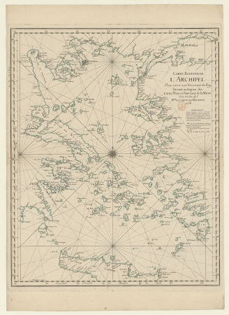
18th-century maps of the aegean sea
jean-fréderic phélypeaux
john rocque 1746 crops from library of congress
john rocque
john rocque 1746 crops from library of congress
john rocque
john rocque 1746 crops from library of congress
john rocque
john rocque 1746 crops from library of congress
john rocque
john rocque 1746 crops from library of congress
john rocque
john rocque 1746 crops from library of congress
john rocque
john rocque 1746 crops from library of congress
john rocque
john rocque 1746 crops from library of congress
john rocque
john rocque 1746 crops from library of congress
john rocque
john rocque 1746 crops from library of congress
john rocque
john rocque 1746 crops from library of congress
john rocque
john rocque 1746 crops from library of congress
john rocque
john rocque 1746 crops from library of congress
john rocque
veteris novae que urbis amstelodamensis ichnographia, continens publica aedificia ; veterem subnigrioribus... delineata auctore d. stalpaert - btv1b53212660h
bibliothèque nationale de france
17th-century maps of the isle of man
maps by willem and johannes blaeu
arnold van langren map of southwest africa
renaissance
veteris novae que urbis amstelodamensis ichnographia, continens publica aedificia ; veterem subnigrioribus... delineata auctore d. stalpaert - btv1b53212660h
bibliothèque nationale de france
maps by willem and johannes blaeu
1640s maps of scotland
1667 map of madagascar by guillaume sanson
bibliothèque nationale de france
collectie archief van architectenbureau baanders
photographs in the stadsarchief amsterdam
maps of asia minor by mercator-hondius
bibliothèque nationale de france
1630s maps of the holy roman empire
maps by willem and johannes blaeu
17th-century maps of england and wales
maps by willem and johannes blaeu
spanish–algerian war (1775–1785)
maps by tomas lopez
1696 maps of the caribbean
1690s maps of mexico
military history of goa
theodor de bry
the illustrated london news 1889
1889 portrait prints
17th-century maps of iceland
iceland map by joris carolus
maps of japan by mercator-hondius
bibliothèque nationale de france
old maps of plymouth and devonport
jan van doetechum
maps of japan by mercator-hondius
bibliothèque nationale de france
bibliothèque nationale de france
maps of wales by humphrey llwyd
l'empire d'allemagne divisé en ses dix cercles, et ces cercles en leurs principaux estats, principautés et souverainetés ecclésiastiques, laiques et villes impériales avecq le royaume de boheme et les... - btv1b53202355w
sanson maps of the circles of germany
1565 maps of asia
niccolo nelli
prints of cartouches in the rijksmuseum amsterdam
maps in the rijksmuseum amsterdam
james weir (royal marines)
battle of the nile
prints of cartouches in the rijksmuseum amsterdam
maps in the rijksmuseum amsterdam
maps of wales by humphrey llwyd
maps by pieter van der keere
18th-century maps of the malay archipelago
1790s maps of china
maps of the iberian peninsula by mercator-hondius
maps by pieter van der keere
old maps of kollam
catherine haussard
schoten, netherlands
heerlijkheid zaanen
etchings in the rijksmuseum amsterdam
carel frederik bendorp (i)
maps of the magellan straits by lambert cornelis
context files from gallica
maps of algiers by braun & hogenberg
bibliothèque nationale de france
1760s maps of the americas
jean janvier
pieter verbiest (ii)
maps from gallica
maps of the americas by mercator-hondius
bibliothèque nationale de france
maps of asia by mercator-hondius
bibliothèque nationale de france
maps of the magellan straits by lambert cornelis
bibliothèque nationale de france
1630s maps of the americas
maps by jodocus hondius ii
maps of lake geneva by jacques goulart
bibliothèque nationale de france
magni ducatus lithuaniae
1710s maps of lithuania
maps of china by mercator-hondius
bibliothèque nationale de france
1580s maps of the americas
frans hogenberg
maps of lake geneva by jacques goulart
bibliothèque nationale de france
maps of lake geneva by jacques goulart
bibliothèque nationale de france
collectie archief van architectenbureau baanders
photographs in the stadsarchief amsterdam
maps of hormuz by braun & hogenberg
hebrew university of jerusalem
chromolithographs in the british museum
durand-brager
john cleveley the elder
thomas milton
old maps of the american civil war
1861 maps
maps of andalusia by mercator-hondius
bibliothèque nationale de france
maps of the caribbean by mercator-hondius
bibliothèque nationale de france
maps of barbary coast by mercator-hondius
bibliothèque nationale de france
maps of rügen by eilhard lubinus
bibliothèque nationale de france
prints by jan luyken in the rijksmuseum amsterdam
maps in the rijksmuseum amsterdam
a & c black general atlas of the world
19th-century celestial maps
admiralty charts region t: west indies and central america
admiralty charts 401-600
magni ducatus lithuaniae
radziwiłł (surname)
maps by jodocus hondius
1590s maps of the world
china veteribus sinarum regio nunc incolis tame dicta
coats of arms on maps
401 - 500 of 675
Next page
/ 7


![Germania, non ea tantum quae Rheno, Vistula, Danubio, mariq[ue] Germanico Veteribus claudebatur; Sed tota illa continens quae hodie communiter Germanicâ linguâ..., 1638](https://cdn.creazilla.com/illustrations/10001049008/germania-non-ea-tantum-quae-rheno-vistula-danubio-mariq-ue-germanico-veteribus-claudebatur-sed-tota-illa-continens-quae-hodie-communiter-germanic-lingu-1638-md.jpg)


![Cambriae typus / Auctore Humfredo Lhuydo Denbigiense Cambrobritanno; Petrus Kaerius coela[vit], 1607](https://cdn.creazilla.com/illustrations/10000351350/cambriae-typus-auctore-humfredo-lhuydo-denbigiense-cambrobritanno-petrus-kaerius-coelavit-1607-sm.webp)


![Algerii Sarace norum urbis forttis fimae, in Numidia Africae Provincia Structae iuxta Balearicos fluctus Maediterranei aequoris Hispaniam contra [...] / [Georg Braun]; [Franz Hogenberg], 1588](https://cdn.creazilla.com/illustrations/10000602342/algerii-sarace-norum-urbis-forttis-fimae-in-numidia-africae-provincia-structae-iuxta-balearicos-fluctus-maediterranei-aequoris-hispaniam-contra-georg-braun-franz-hogenberg-1588-md.jpg)


![China / [J.Hondius], 1606](https://cdn.creazilla.com/illustrations/10001216594/china-jhondius-1606-md.jpg)


